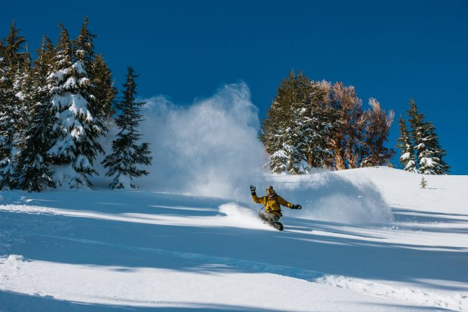
Please and thank you. Photo: Ikon Pass

It’s been a lovely January for many parts of the West: clear and cold. But those regions sitting on healthy snowpacks received little, to no snow during the month. But winter is about to make a serious return as forecasters are calling for up to two feet of fresh snow in parts of the Western U.S. from the Sierra, to the Pacific Northwest and the Rockies. It’s set to be a pow party.
Our friends at PowderChasers, a trusted snow-forecasting site, have made an “epic” call, predicting that high-pressure ridge to finally break down this week after a month-long stay. The first storm should bring snow to the PNW and Colorado in the second half of this week. Storm totals are modest, says the site, with some 3-9 inches predicted. The second part of the site’s forecast is where things get interesting.
“The ridge breaks down over the West by Thursday as storms can re-enter the Pacific Northwest and British Columbia by Friday morning,” wrote PowderChasers. “This low brings ample moisture into this area from Friday to Sunday. Warm air initially on Friday could make the snow slightly upside down with moderate to strong SW winds.
“Colder air arrives in the PNW late Friday to Saturday, with lighter-density powder and even some snow, possibly in the higher elevations of metro areas. The timing for riding powder will be Friday (storm ski) for Whistler and the Cascades of Washington and Oregon (it starts a bit early the further north you travel). Some overnight pow will be found for Saturday morning with much colder temps and winds from the west and northwest.”
The storm totals are still a bit all over the place but according to the report, resorts in Washington, British Columbia, Western Idaho, and Wyoming could get as much as two feet of much-needed powder. Models aren’t agreeing about how much snow the Sierra could receive but given the storm’s northern track, the northern half of the Sierra are probably a safe bet to at least get some new snow. However, starting Friday, local forecasts call for Truckee, California (near Palisades Tahoe) to get moisture daily for almost a week. Always a good sign. Unfortunately, things look a little spotty in the Mammoth Lakes region.
This week started off well, especially in Southern California, which finally received some much-needed moisture (although officials were worried about mud slides after the fires). Mt. Baldy received at least 10 inches to get its season off the ground.
Stay tuned for more winter. You can read PowderChasers full report, here.
Founded in 2010, The Inertia is the definitive voice of surf and outdoors. They approach the natural world and its devoted culture with curiosity, optimism, and respect. They take pride in bringing their passion for the oceans and mountains to life through original films, reporting, and monumental gatherings. They aim to make a positive impact on the planet through partnerships with nonprofits working hard to preserve earth’s sacred places. Be sure to visit The Inertia website to view valuable Surfing and Outdoor related News and Resourceful Articles regularly.
If you are not yet a BRA Retail Member, you can easily opt in to either Regular (no cost) or Distinguished ($100/yr.) Membership via this super simple join form